Quick answer
Babusar Top is roughly 130 km from Shogran via Naran, taking four to five hours each way. The pass sits at 13,691 ft and is typically open only from around July to September or October. Doing it as a day trip from Shogran is possible but means eight to ten hours of driving.
Babusar Top is the high pass that connects the Kaghan Valley to the Karakoram Highway near Chilas. At 13,691 feet it is a genuinely high-altitude drive and one of the more memorable roads in Pakistan. It is also a long way from Shogran, and the single most common planning mistake is underestimating that.
The route
Shogran down to Kiwai (30 minutes), then up the Kaghan road through Paras and Kaghan town to Naran (around two hours from Kiwai), then Naran up to Babusar Top (around two to two and a half hours). Total roughly 130 km and four to five hours in each direction.
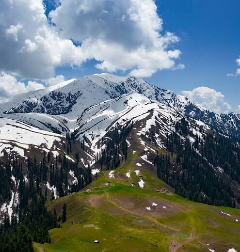
The section above Naran is where it becomes spectacular. The road climbs through Lulusar Lake and onto increasingly bare high country before the final switchbacks to the pass.
When it opens
This is the critical constraint. Babusar Top is snowbound for most of the year. It typically opens somewhere around July and closes with the first significant snowfall, usually somewhere between September and October. Exact dates vary substantially year to year and are decided by conditions rather than a calendar.
If you are planning a trip specifically to cross Babusar, build flexibility in and confirm the current status shortly before you travel. See is Shogran open right now.
Day trip from Shogran? Honestly, no
It can be done. It means leaving Shogran around 4 or 5 AM, eight to ten hours of driving, and arriving back after dark, including the Kiwai climb in the dark, which is precisely what the safety guide advises against.
The much better plan is to move up to Naran for a night or two and do Babusar from there. That cuts each leg to around two to two and a half hours and turns a punishing day into a comfortable one. See Shogran to Naran.
Altitude
13,691 feet is high enough that some people feel it. You will be going from Shogran at 7,749 ft to nearly 14,000 ft in a matter of hours, which is a rapid gain. Headaches and breathlessness at the top are common and usually resolve on descending.
Do not plan a long walk at the pass. Stop, look, take photographs, and come down. If anyone in your group feels genuinely unwell, descending is the treatment.
Practical points
- Fuel at Naran. There is nothing dependable above it.
- Dress for cold. It can be near freezing at the top in the middle of summer, with strong wind.
- Expect no signal for long stretches.
- Check documentation requirements if you intend to continue towards Chilas and the KKH, as this crosses into Gilgit-Baltistan.
- Start early regardless. Weather at the pass deteriorates through the day.
Is it worth it?
If the pass is open and you have the days, yes. It is a genuinely different landscape from the green of Shogran, and the drive itself is the attraction rather than the destination.
If your trip is only two or three nights based in Shogran, skip it. Spend the time on Siri Paye and the valley instead and do Babusar properly on a longer trip.
Our tour packages include multi-day valley itineraries with Naran as an intermediate base, which is the sensible way to do this. Message us with your dates and we will tell you whether the pass is likely to be open.
Key facts at a glance
| Distance from Shogran | About 130 km |
|---|---|
| Driving time | 4-5 hours each way |
| Babusar Top altitude | 13,691 ft / 4,173 m |
| Open season | Roughly July to September/October |
| Route | Shogran to Kiwai to Naran to Babusar |
| Better base | Naran, not Shogran |
Frequently asked questions
How far is Babusar Top from Shogran?
About 130 km via Naran, taking four to five hours each way. That makes a day trip from Shogran an eight to ten hour driving day, which is why most people move up to Naran first.
When does Babusar Top open?
Typically around July, closing with the first significant snowfall somewhere between September and October. Exact dates depend on conditions each year and change, so confirm shortly before travelling.
Do you need a 4×4 for Babusar Top?
The road is metalled for most of its length and ordinary vehicles do make it in good conditions, but it is high, exposed and weather-dependent. A capable vehicle and an experienced driver are strongly advised.
Is Babusar Top hard to breathe at?
At 13,691 feet some people experience headaches or breathlessness, particularly after a rapid ascent from lower altitude. Symptoms usually resolve on descending. Avoid strenuous walking at the pass.